Still working on the pictures on this one, but i wanted to get it posted...
Climbing Kilimanjaro Part two... Climbing Kili’s Rongai Route




A few night shots I got before taking my summit nap...
Climbing Kilimanjaro Part two... Climbing Kili’s Rongai Route
Sunday April 29 2012
Day one: Getting started
Start: Rongai Gate, 1920 meters
Finish: Simba Camp, 2700 meters
Distance walked: approximately 5 km
Time trekking: 2.5 hours
Weather Report: Rainy start,
cloudy finish, warm.
Johnnie and his crew arrived this morning around 8:00 am to pick
up Michelle and me. We had been looking
forward to this for a long, long time, and we knew it would be a long and
increasingly exciting morning. Moshi is south of Mt. Kilimanjaro, and the start
of the Rongai route is on the north side of the mountain just 500 meters short
of the Kenya border. On the ride to the
gate we tried to get to know our porters a little. We were just two obviously. But with leaders and porters our group
numbered 11. The nine others included
Johnnie, our guide; James, our assistant guide; Robert, our cook and six more
porters who carry supplies, set up tents and do all sorts of other “behind the
scenes” work to help make our trek as enjoyable as possible. They are Juma, Nyamaissa, Boniphase, Aloyce,
Christopher, and Kasian. Too often,
porters get forgotten when ordinary people like me try to do extraordinary
things like climb a mountain. As long as
I live I’ll never forget these people, our porters. I cannot thank them enough for their essential
assistance in my success on Kilimanjaro.
We began our hike moments before 2:00 pm. It was raining and
a bit chilly at the start, so we put on our rain clothes, put one foot in front
in of the other, and we were off, off on an adventure that was to become one of
most remarkable and memorable things either of us has ever done.
It didn’t take 15 minutes before the rain stopped and the
sun began to shine. We soon were
shedding layers, and we were sweating within 30 minutes. The majority of the afternoon found us
trekking through Kilimanjaro’s rainforest. I believe we reached the beginning of the Mooreland
Zone shortly before arriving at Simba Camp.
Compared to what was to come, you could call today a rather easy day on
the mountain. We reached Simba Camp
after only 2.5 hours of walking. When we got there we found Juma, Nyamaissa, Boniphase, Aloyce,
Christopher and Kasian all working to set up our camp site. Once all the tents were up it didn’t take
long for us to settle into a routine that would become daily life for the next
week: Sign in to the camp, change into dry clothes, wash up,
go to the “mess” tent for tea and snacks, eat meals, play cards, journal in our
notebooks and go to sleep before 9:00 pm.


 |
| See that little mountain on the left? That's where we're headed |

Monday April 30 2012
Day two: Yes it’s rainy season
Start: Simba Camp 2700 meters
Lunch: 2nd Cave 3400 meters
Finish: Kilelewa camp 3600 meters
Time walking: 7 hours
Distance: 14.2 km
Weather report: visible sunrise, cloudy morning, pouring rain
midday, cloudy afternoon
The morning began just as Johnnie
had promised. We awoke shortly after to
6:00 am to witness a lovely sunrise and
clear views of Kibo and Mawenzi peaks.
Breakfast was delicious. Cinnamon
flavored porridge (“oogie” in Swahili), fried eggs, bacon and sausage. That
ought to provide ample energy for mountain climbing.
We set out for the day around 8:30
am. The sun was shining, and Michelle
and I were still hiking in shorts and tank tops. Unfortunately, the sunshine did not last long
into the morning. By 9:00 am it was
cloudy, and by 11:00 am rain was threatening.
Shortly before lunch it was time to put away the cameras and pull out
the rain gear. It was a little
disappointing of course, but it was not surprising. After all, we were hiking in the raining
season, and the rain was to be expected.
Thankfully, we did manage to make it to Rongai 2nd Cave just before
the skies opened up. We were pretty
happy to be sitting in a tent just as the as the heavy rains came in. We felt bad for Nyamaissa, however, as he
still had to run around in the rain to bring our lunch and refill our water
bottles.


For lunch we had mac and
cheese. Not just any mac and cheese,
however. It was the second best mac and
cheese I have ever eaten in my life – the best ever being enjoyed with my Dad in
a fancy New York City steak house about a year and half ago. As we enjoyed our lunch, the rain came on
harder. Michelle decided to have a
little talk with the rain, and they came to an understanding that we would walk
in it for up to an hour but after that things were going to have to calm down. After lunch we put on our rented ponchos and
gave them a try. They worked out quite
nicely and, happily, the rain stuck with her agreement with Michelle. About an hour after the lunch, the weather
began to brighten up again.
The second half of today was
significantly easier than the first. Yes, lunch was merely half-way through the
day with 7 km to walk on either side of it, but the elevation change before
lunch was nearly 700 meters while after lunch it was only 200 meters.
We rolled in to camp around 4:30
pm this afternoon. We had been through
some rain, but we were relatively dry when we got there and very happy to still
be feeling good. When we stopped to
think about it we were running up this mountain when the pace is compared to
the rate at which we climbed Annapurna.
By the time we had reached 3600 meters in Annapurna we were having lunch
on day six of the trek making our way to base camp. On Kilimanjaro, this was only day two!
When we arrived, our tents were
all set up, so we quickly settled into our respective “tent sides,” changed in
to our mountain “evening wear” (!) and headed over to the mess tent for tea and
popcorn accompanied with some card playing, journaling and, soon enough,
another wonderful dinner. On the menu tonight: creamy carrot soup, chicken,
rice and veggies. I don’t know how
Robert makes such wonderful meals over and over and over again.
Tonight was significantly colder
than the night before. I wore two layers of pants and four tops, and it simply
was not enough. I had Johnnie fill my
water bottle with boiled water and took it to bed with me.
Tuesday May 1, 2012
Day three: up the mountain and through the fog
Start: Kilelewa camp 3600 meters
Finish: Mawenzi Tarn Hut 4200 meters
Distance walked: 5 km
Time walking: about 3 hours
Weather Report: Sunny, followed by clouds, followed by fog,
followed by rain, followed by more clouds
Things started out very sunny and beautiful, just like the
previous mornings. We have a beautiful
view of Mawenzi Peak to the south, and to the north Kenya is easily visible. After our standard oogie, eggs, toast and
bacon breakfast with assorted teas, coffee and Milo options, we were off by
8:30 am. It was either this morning or
yesterday morning that we started drinking the milo. Milo is kind of like hot chocolate, but it’s
got a whole load of vitamins added to it.
We had left it on the table many mornings in Peru and Patagonia, but
when we actually examined the label here in Tanzania, we decided all the
vitamins might not be a bad idea, and we managed to finish the entire can of
this powdered goodness by the end of the week.
Today was to be a rather short day. We expected to be at
Mawenzi Tarn Hut before lunch, and that was to be our campsite for two
nights. We’re getting into some
semi-serious elevation now, and it’s time to start slowing down, big time. What was our slow and steady game plan? It was stop every 20 minutes for water with
every third break being a bit longer to include a “stop in the bush” and a
snack.
It was rather cold this morning, too, cold enough to start
the day in pants and several layers.
However, we were once again shedding layers within about 20 minutes. Don’t get me wrong, it was still cold, but we
were working hard and became pretty warm while hiking. About 60 to 90 minutes into the morning the clouds
and fog began to roll in. Thankfully the
rain held off until close to 10:30 am when Johnnie told us we only had about 40
minutes to go, even with our frequent breaks.
The rain continued on for only about another 20 minutes, and we were at
our campsite in less than an hour.


We considered doing an acclimation hike after lunch, but the
weather was incredibly disagreeable, and Johnnie said we would be fine if we
waited until tomorrow. We had just
climbed 600 more meters higher in to the sky, and resting at the newly-achieved
altitude is not a bad idea either. So
after our chicken with cheesy potatoes lunch, it was a long afternoon of card
playing, journal writing, and tea consumption.
Johnnie and James joined us for some card playing during the afternoon. We taught them our favorite traveling card
game, Last Man Standing. They taught us
the game all the porters and guides like to play, something called Last
Card. For me, however, it’s Kilimanjaro
because that is where I learned to play.
It was during this session of cards that we also learned a few more
Swahili phrases.
Nimendoka! – awwwww man! Or awwwww nuts!
Tune cheza karata! – We’re playing cards!
Ongara! – Congratulations!
Simama – Stop!
Twende sasa! – Let’s go now! (Actually, we learned this one
the first day)
Maji – Water.
As the afternoon tuned into evening, it got very cold, very
fast. More layers tonight, but I’m still
saving one or two for Kibo – assuming 500 meters higher means even colder. Tonight’s dinner included creamy onion soup,
macaroni with green beans and vegetable sauce.
Once again, it tasted absolutely incredible. I don’t know how Robert
makes all this wonderful food up here.
He claims to have taken only a one-day cooking class and figured the
rest of it out. Everything he knows
about cooking at altitude he taught himself.
After dinner, Johnnie came to pay us another visit before
bed. This time he inquired about how we
were feeling and whether we felt as if we were having any trouble with the
altitude. Smiling, we both assured him
we were doing great. He was happy to
hear this news as apparently it is after 4000 meters (we’re camping at 4200)
that many people begin to experience altitude sickness and can fight a serious
battle with it while attempting to acclimate.
Even many people on Diamox start to get sick at 4000 meters
and above. I don’t think I mentioned
anything about Diamox yet. Diamox is a prescription medication used to prevent
altitude sickness, or AMS – acute mountain sickness. In an attempt to keep those of you still with
me to continue reading, I’ll not go on about Diamox. I just say this: It make
you need to use “facilities” VERY FREQUENTLY, and increases your respiratory
rate significantly.
We went to bed shortly after dinner. We were not going to another campsite
tomorrow, but we did need to get up at a decent time if we were to complete our
acclimation hike in decent weather.
For me, tonight was definitely the most difficult night on
the mountain. It was the coldest I have
ever been while trying to sleep. In
fact, it was so cold that I woke up several times shivering almost beyond
control. On one such occasion I awoke, pulled from slumber only to realize that
my waking up was accompanied by an unwelcome wave of nausea. Unfortunately, this realization was followed
immediately by – well, it was followed by what happens after you get nauseous. Let’s just say it was not pretty.
I was nervous that Johnnie was going to come and tell me it
was the altitude, and I was going to have to turn around and go back down. But he was actually very perplexed by the whole
thing having never seen someone get sick so many hours after reaching a new
altitude. Usually, if you’re going to
get sick from altitude, it going to happen a whole lot sooner. Was it dinner? I've had more food poisoning than I care to remember on this trip already. A food allergy, maybe? No one truly knows. Okay, enough about that. On to tomorrow.
Wednesday May 2, 2012
Day Four: Acclimation Day
Start: Mawenzi Tarn Hut 4200 meters
Acclimate to 4850+ toward the top of Mawenzi
Finish: Mawenzi Tarn Hut 4200 meters
Distance: no one truly knows
Time walking: 3 to 4 hours
Weather Report: rain, clouds, wind, rain and hail.
We slept a little later than normal this morning, 7:00 am,
as it was raining from the get-go with no clear sky to admire, and we were
going to take that acclimation hike rain or shine. Today’s hike would take place on Mawenzi
Peak. The goal: go as high as we can.
During dinner last night we quizzed Johnnie about how high Mawenzi is, how high
he thought we could make it and what he normally sees in others. Mawenzi Peak is 5100-something meters. Our immediate reaction was, “We want to go to
the top.” We quickly learned that the
top was an impossibiity as it becomes a technical climb above 4900 meters. Okay fine, “Can we go to 4900?” Well, not
exactly, it’s very steep and gets rather rocky past 4800 meters. And that is how we concluded our destination
would be “as far as we can get.”
When we started there was no rain, but quite a bit of
fog. I was feeling pretty wiped out,
having given my dinner back to Mother Nature in the middle of the previous
night. Once again we stuck with our stop
for water every 20 minutes plan, and it worked well. I was actually feeling
better, finding about an hour into the hike that I had more energy than I’d
started with. This was about the time we
had to pull out our ponchos, too. Cameras
in, ponchos out, sideways rain with a mix of hail, and did I mention how easy
it was to see where I was walking on the uneven terrain as the wind was blowing
my poncho all over the place?
We kept going and going and going. At one point we wound up right up next to a
rock wall which offered a nice, albeit brief, protection from the
elements. When we came around the end of
the rock wall the terrain turned from uneven and tricky to seemingly STRAIGHT
UP. I think it was steeper than a 45
degree angle upwards. Johnnie went
running straight up the mountain. Meanwhile, James created a switchback path
for us to follow. That was when I realized there were zero footprints on the ground. We were the first to be hiking here in a very
long time. Up we went, switch and back,
switch and back until we met Johnnie’s smiling face at the end of the scree and
beginning of the rocks. Johnnie said it
was a just a bit further until we would be at the 4900 meter mark. Our jaws dropped, WHAT?!? We’re already that high? “Yes, it’s just up here and then around there
and a little bit past those rocks before it turns technical,” Johnnie said, as
he pointed into the foggy pile of rocks, pointing in no place that appeared
distinguishable or even possible in my mind.
Now, I am by no means a quitter or one to take short cuts. Had the weather been a bit dryer or if I could
see some of the rocks Johnnie was pointing at, I would likely have happily run
up those rocks. But not today. With the fear of injury as the summit was getting
closer, Michelle and I opted for the non-broken ankles and saving a bit of
energy alternative. I think Johnnie was
a tiny bit disappointed that we chose not to follow him up. At this point Johnnie told us that not one
person he has taken up the Rongai route has ever made it this far on the
acclimation hike!
Really? Well Ongara, Katy and Michelle! I think I
deserve my Snicker’s bar now!
What took us over three hours to climb up took less than 45
minutes to go down, and before we knew it we were back at in our mess tent for
another delicious meal. Soon after that
we changed in to our clean and dry clothes and settled in for another evening
of tea drinking, journal writing and card playing. I added two more layers of clothes before bed
tonight. It worked, too. Yes, I was still cold, but there were no rude
awakenings to deal with uncontrollable shivering either.
Thursday May 3, 2012
Day five: through the alpine forest
Start: Mawenzi Tarn Hut 4200 meters
Finish: Kibo Camp 4700 meters
Distance walked: 9 km
Times walking: 4.5 hours
Weather report: A lot of clouds and fog with a moderate
amount of rain.
Michelle and I woke up a little late this morning. It was
much closer to 7:00 am than our usual 6:00 am to 6:30 am. I think out team had a late start as well,
because they were not moving very fast either when we woke up. It was raining again this morning, so were in
no hurry to get moving and put our wet ponchos on over our dry clothes. But we had to go sometime. We finally set out around 9:00 am.


It remained cloudy with rain on and off throughout the
hike. Nothing about today was steep, by
any means, but it was not easy either.
It was a long, gradual climb up to Kibo.
Throughout the day the guys passed us with all our tents and supplies
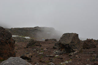
(thanks guys!), and we slowly made our way into the alpine desert. The pictures of today are interesting. It just looks like a big wide open plain, but
every once in a while the clouds in the sky towards Kibo would thin and you see
the camp tucked in to the side of mountain and even, finally, catch a glimpse
of the idea that you are on a magnificent mountain. The increasingly difficult breathing and the
need to go pole pole (slowly) provided the constant reminder that this was no “plain.”
We arrived at Kibo around 1:30 pm. The plan for the
afternoon was simple. Eat lunch, take a
nap, eat dinner, take another nap, get up and climb to the top of Mt
Kilimanjaro! What could be simpler?
I don’t believe Michelle got any sleep at all in the three
hours between lunch and dinner. I maybe
slept 45 minutes total.
 |
| Enjoying my lunch |
After our spaghetti and meat sauce dinner, Michelle and I
had a grand plan to sleep in the clothes we were going to hike in so we could
just get up and go, but that turned out to be easier said than done and I wound
up in my now-standard, eight-layer sleeping outfit for the next few hours.
A few night shots I got before taking my summit nap...
 |
| Looking back at Mawenzi |
 |
| almost full moon-lit sky |
 |
| Destination Uhuru Peak |

